We study how robots estimate their position, reconstruct their surroundings, and maintain spatial information that supports action. Our research connects visual localization and 3D reconstruction with active sensing, object-level scene understanding, and perception of dynamic environments.
Published research
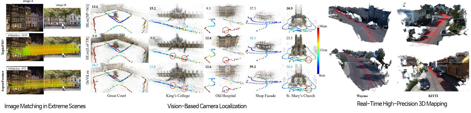
Reliable spatial perception starts with establishing correspondences across images and connecting observations to a 3D map. We develop feature-matching and visual-localization methods for scenes affected by changes in illumination, viewpoint, weather, and appearance.
TopicFM and TopicFM+ use latent topic representations to guide matching between related image regions. Our semi-dense localization method extends 2D-3D correspondences beyond predefined map points by inferring scene coordinates from geometric and visual cues. These methods provide components for camera pose estimation and image-based mapping.
Published research
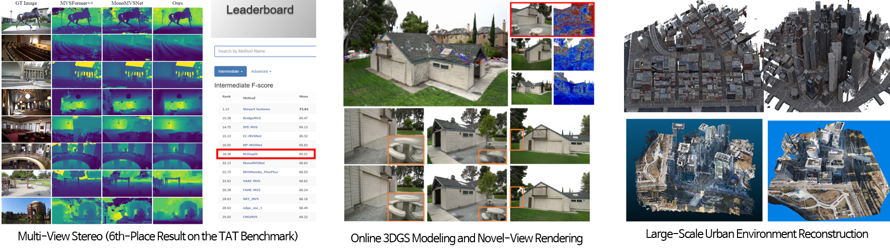
We reconstruct scene geometry from overlapping images and develop scene representations that support novel-view rendering. Our work addresses both depth-estimation quality and the practical limits of updating a model as new images arrive.
Curvature-guided feature extraction adapts matching support to local surface structure, while prior-depth-based multi-view stereo (MVS) reuses sequential depth estimates to improve online reconstruction. For 3D Gaussian Splatting (3DGS), adaptive view selection adds informative non-keyframes to refine incomplete regions. PR-IQA evaluates diffusion-generated views against reference observations and uses quality estimates to filter unreliable supervision.
Published research; latest work accepted to IROS 2026
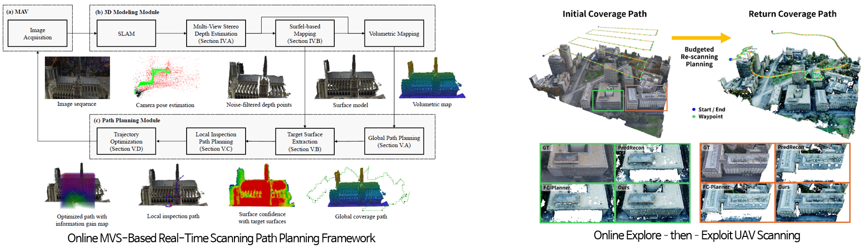
A robot's viewpoint determines which surfaces can be reconstructed. We combine online 3D modeling with view-path planning so an aerial robot can respond to missing or weakly reconstructed regions during data collection.
Our methods analyze the evolving surface model, identify inspection targets, and plan observations that improve coverage and geometric quality. Recent work combines an initial coverage pass with targeted return re-scanning within a limited flight budget. The objective is to direct sensing effort toward regions where additional observations are most useful.
Ongoing research
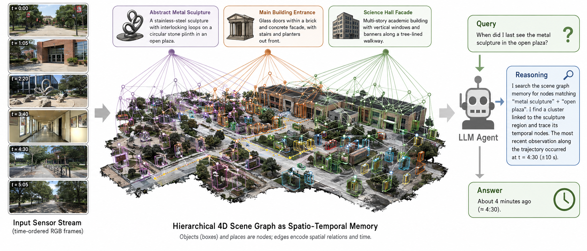
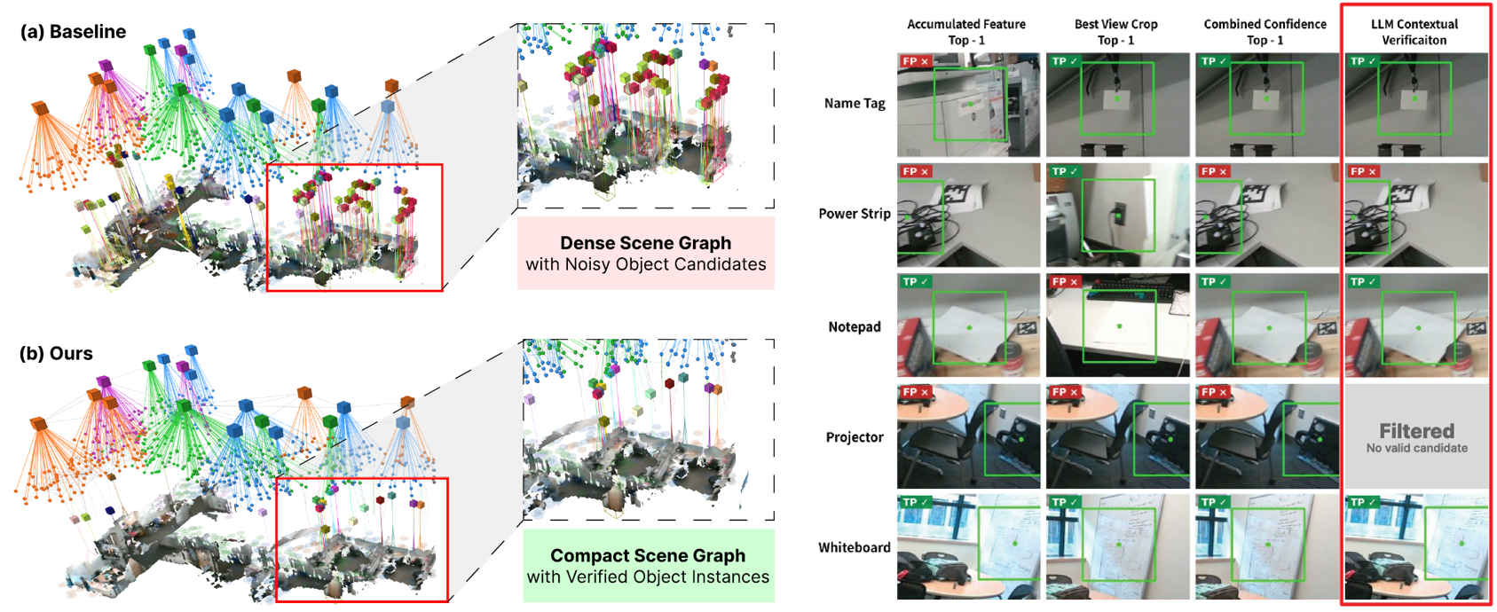
A geometric map describes shape, but robot tasks also require information about objects and their relationships. We investigate 3D scene graphs that connect object instances, spatial relations, and visual evidence in a form that can support language-guided planning.
Our current approach combines observations from selected views with contextual spatial constraints to examine uncertain object candidates. We aim to reduce false detections and construct more compact object representations, while keeping task plans grounded in evidence from the environment.
Ongoing research
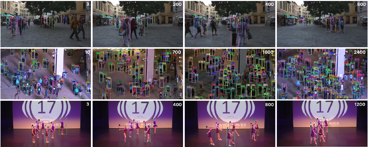
Robots operating around people need to distinguish moving objects and maintain their identities over time. We investigate multi-object tracking in video sequences, focusing on the difficulty of associating observations when objects overlap, disappear from view, or change appearance.
The goal is to provide temporally consistent information about dynamic scenes that can complement localization and mapping. Our research examines how detection and association can preserve useful object tracks in crowded environments and through intermittent observations.